


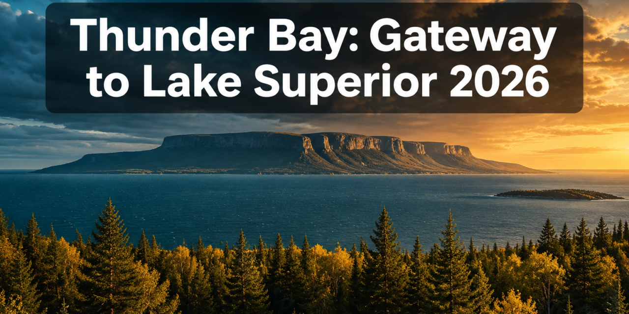
Thunder Bay Gateway to Lake Superior 2026: Sleeping Giant Hikes, Kakabeka Falls, and Ouimet Canyon Adventures
Last updated: May 6, 2026
Quick Answer: Thunder Bay sits at the western edge of Lake Superior and serves as the launch point for three of northern Ontario’s most dramatic natural attractions: Sleeping Giant Provincial Park, Kakabeka Falls, and Ouimet Canyon. In 2026, the region remains one of Canada’s least crowded wilderness destinations, making it ideal for hikers, road-trippers, and nature lovers who want big scenery without the lineups.
Key Takeaways
- 🥾 Sleeping Giant Provincial Park holds over 100 km of hiking trails, Ontario’s largest provincial park trail network [1]
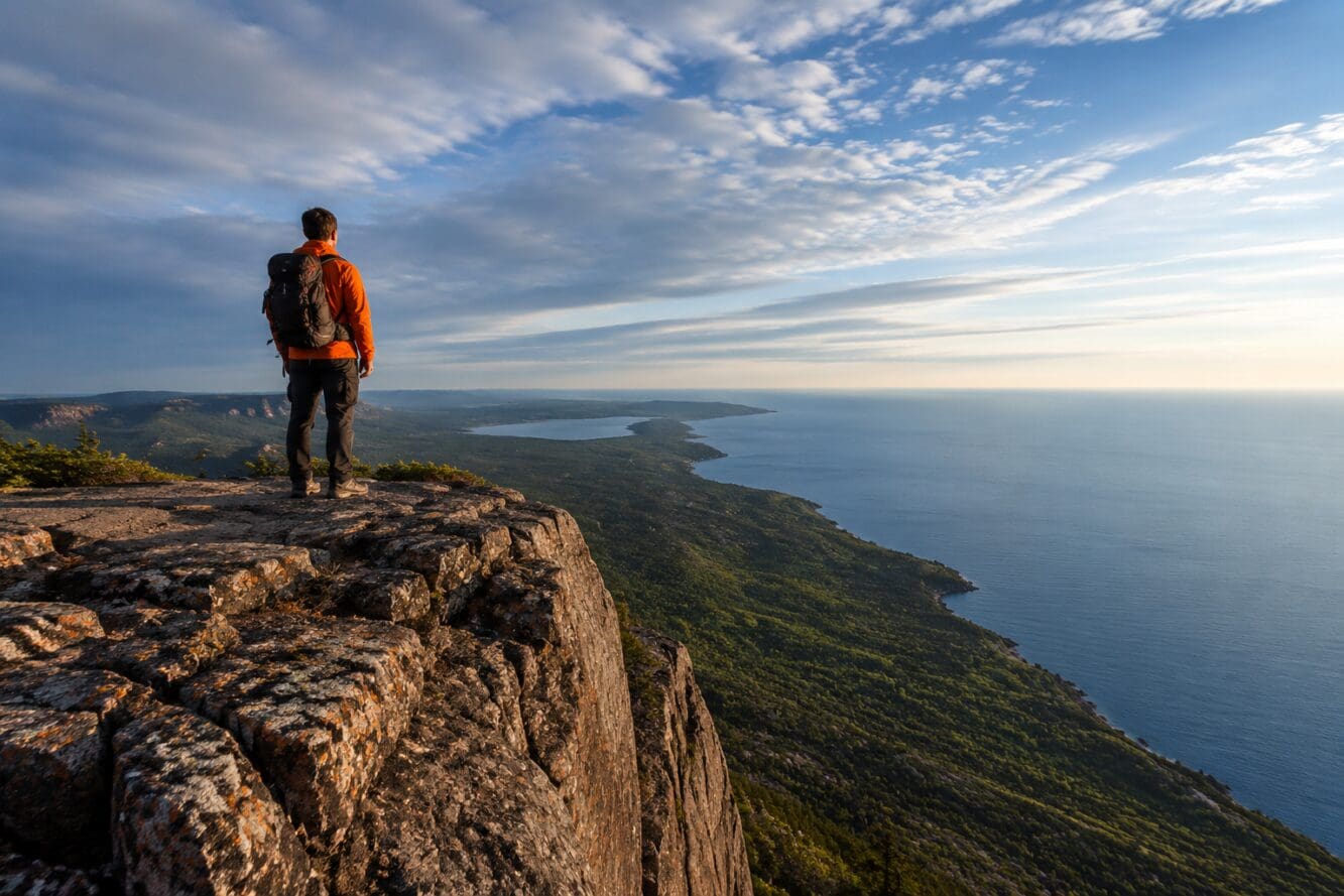
- 🏔️ The Top of the Giant hike is a 22 km round-trip with cliffs rising 200+ metres above Lake Superior [5][7]
- 💧 Kakabeka Falls, nicknamed the “Niagara of the North,” drops 40 metres and is one of Ontario’s most accessible natural wonders
- 🌄 Ouimet Canyon features sheer volcanic rock walls up to 100 metres high with rare Arctic plant species surviving on the canyon floor
- 🌉 Eagle Canyon Adventures hosts Canada’s longest suspension bridge, adding a thrilling stop between Thunder Bay and Ouimet Canyon
- 🚗 Thunder Bay is roughly 14 hours by car from Toronto and 8 hours from Sudbury — best tackled as a dedicated road trip
- 📅 Summer (June–September) is peak season; permits are required year-round for day use and camping in Sleeping Giant Provincial Park [2][3]
- 🦌 The park’s boreal forest supports wolves, lynx, deer, foxes, and over 200 bird species [3]
Why Thunder Bay Is Northern Ontario’s Best Wilderness Base in 2026
Thunder Bay sits at the crossroads of the Trans-Canada Highway and the Lake Superior shoreline, making it the natural hub for the Thunder Bay Gateway to Lake Superior 2026: Sleeping Giant Hikes, Kakabeka Falls, and Ouimet Canyon Adventures circuit. All three major attractions sit within 90 minutes of the city core, so visitors can base themselves in Thunder Bay and take day trips rather than hauling camping gear to multiple sites.
The city itself offers solid infrastructure: direct flights from Toronto and Winnipeg, a growing food scene, and comfortable accommodation options ranging from downtown hotels to lakeside cottages. For road-trippers coming from southern Ontario, the drive through Sudbury and along the Lake Superior shoreline on Highway 17 is a destination in itself.
Sleeping Giant Provincial Park: What Hikers Need to Know
Sleeping Giant Provincial Park is the centrepiece of any Thunder Bay Gateway to Lake Superior 2026 itinerary. The park covers 61,157 acres (24,751 hectares) on the Sibley Peninsula and sits approximately 20–45 km east of Thunder Bay [2].
Top of the Giant Trail: The Signature Challenge
The Top of the Giant hike is a 22 km round-trip starting from the Kabeyun trailhead. It involves steep switchbacks and a final 2.7 km climb to the summit [5]. The cliffs at the top stand over 200 metres (656 feet) above Lake Superior, delivering 360-degree views across the peninsula, Thunder Bay harbour, and the open lake [7].
Who it’s for: Hikers in good physical condition with a full day available (allow 6–8 hours). Not recommended for beginners or young children.
What to bring:
- Sturdy hiking boots (ankle support essential on switchbacks)
- Minimum 2 litres of water per person
- Warm layers — summit temperatures can drop sharply
- Basic first aid kit
- Snacks for sustained energy [5]
Easier Trails for Families and Beginners
The park offers shorter trails ranging from 500 metres to a few kilometres, including the Sea Lion Trail and Sibley Creek Trail. These are well-suited to families with kids or anyone who wants to experience the park’s boreal forest without committing to a full-day climb [7].
Kabeyun Trail: The Backcountry Option
For multi-day adventurers, the Kabeyun Trail follows the Lake Superior shoreline for 40 km, passing multiple beaches and coves. It has 40 designated backcountry campsites available year-round [1]. This is one of the most scenic and least-visited long-distance routes in Ontario.
Permits: Day use and camping permits are required year-round. Pay-and-display machines are located at Joeboy Lake parking lot and near the Park Office [2].
Kakabeka Falls: The “Niagara of the North”
Kakabeka Falls drops approximately 40 metres over ancient Precambrian rock, making it one of Ontario’s tallest waterfalls. Located just 29 km west of Thunder Bay on Highway 11/17, it’s the easiest major stop on the Thunder Bay circuit — a 10-minute walk from the parking lot reaches the main viewing platform.
Best time to visit: Late spring and early summer, when snowmelt pushes water volume to its peak. The falls are dramatic even in late summer, and the surrounding Kakabeka Falls Provincial Park has picnic areas, short walking trails, and interpretive signage about Ojibwe history tied to the site.
Practical tip: Arrive before 10 a.m. in July and August to avoid tour buses. Admission is a provincial park day-use fee, payable at the gate.
Ouimet Canyon: Ontario’s Hidden Geological Wonder
Ouimet Canyon sits about 60 km northeast of Thunder Bay off Highway 17 and is consistently underrated. The canyon stretches roughly 150 metres wide and 100 metres deep, carved by glacial meltwater through ancient volcanic rock. Two viewing platforms at the canyon rim offer unobstructed views down into a shadowed gorge where rare Arctic plant species survive because sunlight rarely reaches the canyon floor.
Choose Ouimet Canyon if: You want dramatic scenery with minimal hiking effort. The rim walk is short and accessible, making it a strong option for mixed-ability groups.
Common mistake: Visitors often skip Ouimet Canyon in favour of spending a second day at Sleeping Giant. That’s understandable, but the canyon’s geological character is genuinely different — it’s worth the 45-minute detour from Thunder Bay.
Eagle Canyon: Adding Canada’s Longest Suspension Bridge to Your Route
Eagle Canyon Adventures, located between Thunder Bay and Ouimet Canyon, features Canada’s longest suspension bridge spanning a forested canyon. It’s a paid attraction (check current pricing directly with the operator for 2026 rates) that adds roughly two hours to a day trip toward Ouimet.
The bridge sways noticeably underfoot — not for those with a serious fear of heights, but genuinely thrilling for everyone else. A zipline option is also available for those who want more adrenaline.
2026 Road Trip Planning: Getting to Thunder Bay
| Starting Point | Distance | Approximate Drive Time | Recommended Route |
|---|---|---|---|
| Toronto | ~1,400 km | 13–15 hours | Hwy 400 N → Hwy 69 → Hwy 17 W |
| Sudbury | ~700 km | 7–8 hours | Hwy 17 W along Lake Superior shore |
| Winnipeg | ~700 km | 7–8 hours | Trans-Canada Hwy 1 E |
Road trip tip: The stretch of Highway 17 between Wawa and Thunder Bay along the Lake Superior shoreline is one of Canada’s most scenic drives. Build in stops at Agawa Rock Pictographs and White River to break up the journey.
For those interested in berry picking in Ontario along the route, the boreal roadsides between Wawa and Thunder Bay offer wild blueberries in late July and August — a genuine northern Ontario experience. Fans of Ontario’s broader biodiversity will also appreciate how the Lake Superior corridor represents one of the continent’s most intact temperate-boreal transition zones.
The region’s towering birch tree stands are especially striking in September when the leaves turn gold against the dark spruce backdrop — making fall an underrated time to visit. Those interested in northern Ontario’s coast-to-coast travel connections will find Thunder Bay a natural pivot point between eastern and western Canada.
FAQ
Q: Do I need to book Sleeping Giant Provincial Park in advance?
Day-use permits don’t require advance booking — pay at the trailhead machines. Camping reservations for the main campground should be booked through Ontario Parks well in advance for July and August.
Q: How long does the Top of the Giant hike take?
Most fit hikers complete the 22 km round-trip in 6–8 hours. Start by 7 a.m. to finish comfortably before dark [5].
Q: Is Ouimet Canyon accessible for people with mobility limitations?
The viewing platforms are accessible via a short, relatively flat path from the parking area. The canyon rim itself is not a strenuous walk.
Q: What wildlife might I see in Sleeping Giant Provincial Park?
The park’s boreal forest supports deer, wolves, foxes, lynx, and over 200 bird species. Early morning is the best time for wildlife sightings [3].
Q: Can I swim at Kakabeka Falls?
Swimming is not permitted near the falls due to strong currents. The Kaministiquia River downstream has some calmer spots, but check posted signage on-site.
Q: Is the Kabeyun Trail suitable for solo hikers?
It’s manageable solo for experienced backcountry hikers, but always register your trip plan with Ontario Parks and carry a satellite communicator given the remote terrain [1].
Q: When does Sleeping Giant Provincial Park open each year?
The park is open year-round, though some facilities are seasonal. Winter hiking and snowshoeing are popular from December through March [3].
Q: How far is Eagle Canyon from Thunder Bay?
Eagle Canyon Adventures is approximately 50 km east of Thunder Bay, about a 40-minute drive on Highway 11/17.
Conclusion: Plan Your Thunder Bay Adventure for 2026
The Thunder Bay Gateway to Lake Superior 2026: Sleeping Giant Hikes, Kakabeka Falls, and Ouimet Canyon Adventures circuit is one of the most rewarding wilderness road trips in Canada — and it remains genuinely uncrowded compared to national parks in the Rockies or Algonquin in peak season.
Actionable next steps:
- Book accommodation in Thunder Bay at least 6–8 weeks ahead for July/August travel
- Reserve Sleeping Giant campground through Ontario Parks if planning an overnight stay
- Plan the Top of the Giant hike as a standalone full day — don’t combine it with other major stops
- Add Kakabeka Falls as an afternoon stop on arrival or departure day (it’s right on Highway 11/17)
- Pair Ouimet Canyon with Eagle Canyon on a single day trip northeast of Thunder Bay
- Drive the Lake Superior shoreline on Highway 17 from Sudbury — the scenery justifies the route
Thunder Bay rewards those who show up prepared. The trails are real wilderness, the falls are genuinely powerful, and the canyon views are unlike anything else in Ontario.
References
[1] Hiking Giant Ontarios Largest Network Hiking Trails – https://northernontario.travel/thunder-bay/hiking-giant-ontarios-largest-network-hiking-trails
[2] Sleeping Giant Provincial Park – https://lakesuperiorcircletour.info/location/sleeping-giant-provincial-park/
[3] Sleepinggiant – https://www.ontarioparks.ca/park/sleepinggiant
[5] Top Of The Giant – https://superiorhiking.com/top-of-the-giant/
[7] Sleeping Giant Provincial Park Hiking Trails – https://superiorcountry.ca/nature-adventure/hiking-trails/sleeping-giant-provincial-park-hiking-trails/
Content, illustrations, and third-party video appearing on GEORGIANBAYNEWS.COM may be generated or curated with AI assistance or reproduced pursuant to the fair dealing provisions of the Copyright Act, R.S.C. 1985, c. C-42. Attribution and hyperlinks to original sources are provided in acknowledgment of applicable intellectual property rights. Such referencing is intended to direct traffic to and support the original rights holders’ platforms.


