


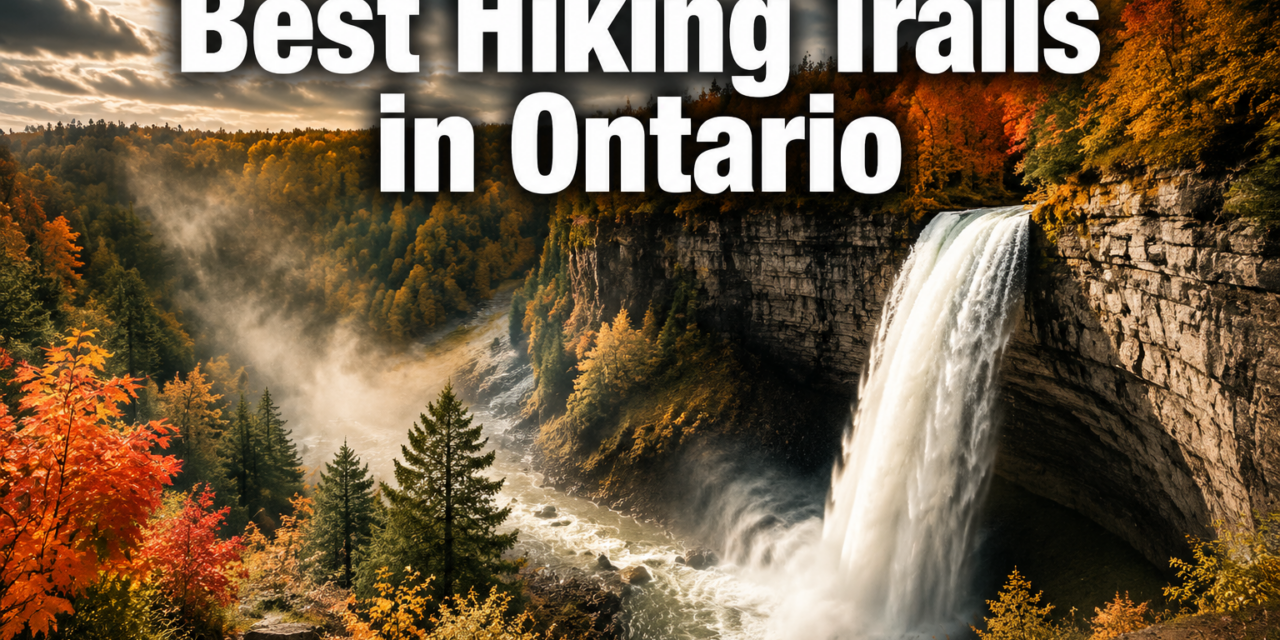
💯 Best Hiking Trails in Ontario: 15 Scenic Routes for Waterfalls, Lookouts, and Day Hikes
Last updated: June 14, 2026
Quick Answer: Ontario has over 400 provincial parks and thousands of kilometers of marked trails, making it one of Canada’s most varied hiking destinations. The best hiking trails in Ontario span everything from easy waterfall loops near Hamilton to challenging ridge walks above Lake Superior. This guide covers 15 scenic routes matched to difficulty, scenery type, and region so hikers can plan the right trip without guesswork.
Key Takeaways
- The Track and Tower Trail in Algonquin Provincial Park is Ontario’s most popular hike, covering 7.9 km in roughly 2 hours and 15 minutes [1]
- The Bruce Trail stretches 890 km along the Niagara Escarpment and is Canada’s oldest marked trail, offering waterfalls, lookouts, and day-hike sections [3]
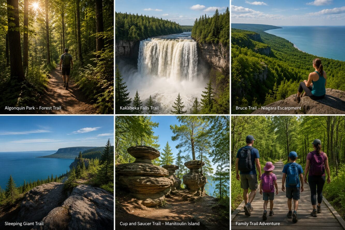
- Kakabeka Falls drops 40 meters, making it Ontario’s second tallest waterfall, accessible via an easy 4.6 km loop [4]
- Most day-use provincial park trails cost between $10 and $20 per vehicle for a day pass; many conservation areas charge $5 to $10 per adult
- Late May through mid-October is the most reliable hiking window; late September to mid-October adds peak fall colour
- Families with young children do best on trails under 5 km with minimal elevation gain, such as Booth’s Rock Trail or Tiffany Falls
- Wildlife commonly spotted includes white-tailed deer, moose, great blue herons, black bears, and beavers
- Several Ontario trails offer paved or boardwalk sections suitable for wheelchairs and strollers
- Solo hikers, including solo female hikers, are well-supported on popular day trails with cell coverage and high foot traffic
- Common mistakes include underestimating elevation gain, starting too late in the day, and skipping bug repellent in summer
What Are the Top 5 Most Scenic Hiking Trails in Ontario
Ontario’s most scenic trails combine dramatic elevation, water features, and geological variety in a single route. Based on visitor volume, photographic appeal, and trail quality, these five stand out across the province.
1. Sleeping Giant Provincial Park (Thunder Bay region) – The park holds more than 100 km of trails, including a challenging 22 km trek to the top of the Sleeping Giant. The summit sits above Ontario’s tallest cliffs, with unobstructed views over Lake Superior [2].
2. Track and Tower Trail, Algonquin Provincial Park – This 7.9 km moderate loop delivers forest canopy, lake views, and remnants of a historic railway. It’s the most-hiked route in Ontario [1].
3. Cup and Saucer Trail, Manitoulin Island – At 8.9 km, this trail passes through ancient geological formations and reaches elevated lookouts over Georgian Bay. Average completion time is about 2 hours and 23 minutes [1].
4. Bruce Trail, Niagara Escarpment – Canada’s oldest marked trail runs 890 km but is easily broken into day sections. Highlights include waterfalls, limestone cliffs, and sweeping valley views [3].
5. Webster’s Falls and Tews Falls, Spencer Gorge (Hamilton) – Webster’s Falls drops 22 meters in a wide curtain, while Tews Falls plunges 41 meters in a slender column. Both are reachable via connecting forest trails [6].
How Difficult Are These Ontario Hiking Trails for Beginners
Most of the 15 trails in this guide fall into easy or moderate categories, and several are genuinely beginner-friendly. Beginners should target trails under 6 km with less than 150 meters of elevation gain.
Good beginner picks:
- Booth’s Rock Trail, Algonquin (6.1 km easy loop) [1]
- Tiffany Falls, Sherman Falls and Lower Little Falls, Dundas Valley (3.9 km, about 1 hour) [4]
- French River and Recollet Falls Trail (3.2 km moderate) [4]
- Kakabeka Falls loop (4.6 km easy) [4]
Trails to avoid as a first hike:
- Sleeping Giant summit (22 km, significant elevation)
- White River Suspension Bridge Trail, Pukaskwa (18 km out-and-back)
Choose a trail rated easy if this is your first Ontario hike or if you’re bringing children under age 8. Moderate trails suit hikers who walk regularly but don’t train specifically for elevation.
Which Ontario Hiking Trails Have the Best Waterfall Views
Ontario’s waterfall hikes are concentrated in two regions: the Niagara Escarpment near Hamilton and the northern parks near Thunder Bay and Algonquin. For sheer volume of falls in one outing, the Hamilton area wins.
Top waterfall trails:
TrailFallsHeightDifficultyWebster’s and Tews Falls, Spencer Gorge2 falls22 m / 41 mEasy-ModerateKakabeka Falls LoopKakabeka Falls40 mEasyInglis Falls, Owen SoundInglis Falls18 mEasy-ModerateTiffany, Sherman and Little Falls, Dundas3 fallsVariesEasyHigh Falls, Algonquin (Barron River)Natural slideN/AEasyRecollet Falls, French RiverRecollet FallsN/AModerate
Inglis Falls near Owen Sound cascades over rugged limestone and is surrounded by an accessible trail system with multiple lookout points [6]. High Falls in Algonquin offers a natural rock slide on the Barron River, with swimming access upstream, making it popular with families [5]. For the southern Ontario winter getaway crowd, frozen waterfall hikes near Hamilton remain a draw from December through February.
How Much Does It Cost to Access These Hiking Trails
Most Ontario provincial park trails require a day-use vehicle permit. Conservation area trails charge per adult. Many Bruce Trail sections cross public land and are free.
Typical costs in 2026:
- Ontario Provincial Parks day-use vehicle permit: approximately $14 to $20 per vehicle
- Conservation area entry (e.g., Spencer Gorge, Dundas Valley): $5 to $10 per adult
- Bruce Trail access on Crown land: free
- Pukaskwa National Park (Parks Canada): approximately $10 per adult daily
Buying an Ontario Parks annual vehicle permit saves money for hikers who plan more than four visits per season. Parks Canada Discovery Passes cover national park fees for a full year.
Are These Trails Good for Families with Kids
Several trails on this list are excellent for families. The key factors are trail length, surface type, and the presence of a clear payoff (a waterfall, a lookout, or a swimming hole) that keeps younger hikers motivated.
Best family picks:
- Booth’s Rock Trail, Algonquin: gentle terrain, forest setting, scenic lookout at the end [1]
- Tiffany and Sherman Falls, Dundas Valley: short, multiple waterfall rewards, well-marked [4]
- Kakabeka Falls Loop: paved viewing platforms, easy walking, dramatic falls [4]
- High Falls, Algonquin: swimming access makes it a hit with kids in summer [5]
Avoid the Sleeping Giant summit and the White River Suspension Bridge Trail for children under 10. Both involve long distances and uneven terrain.
What Time of Year Is Best for Hiking in Ontario
Late May through mid-October is the best window for hiking most Ontario trails. Each season has a distinct character.
- Spring (May to early June): Waterfalls run at peak volume from snowmelt. Trails can be muddy. Black flies are active in May and June, especially in northern parks.
- Summer (late June to August): Longest daylight hours, warm temperatures. Mosquitoes are present near water. Best for swimming at High Falls.
- Fall (mid-September to mid-October): Peak foliage colour, cooler temperatures, fewer insects. The most photogenic season for forest trails.
- Winter (November to April): Some trails remain open for snowshoeing. Ice on rocks near waterfalls creates hazards. Check park websites before visiting.
For those interested in southern Ontario skiing combined with a winter hiking day, the Georgian Bay region offers both within an hour’s drive.
What Gear Do I Need for Ontario Day Hikes
For a standard Ontario day hike of 4 to 10 km, a small pack with the right essentials is enough. No technical gear is required for easy or moderate trails.
Core gear checklist:
- Sturdy trail shoes or hiking boots with ankle support
- 1.5 to 2 liters of water per person
- Snacks or a packed lunch
- Sunscreen and insect repellent (essential May through August)
- Rain jacket (Ontario weather changes quickly)
- Trail map or downloaded offline GPS route
- Basic first aid kit
- Fully charged phone
For northern parks like Sleeping Giant or Pukaskwa, add a bear canister or bear spray, a headlamp, and an emergency whistle. Day hikes in Algonquin during spring and early summer require serious bug protection.
Are There Wheelchair Accessible Trails in Ontario
Yes. Several Ontario parks have paved or boardwalk sections that accommodate wheelchairs and strollers. Not every trail is fully accessible, but the options have expanded significantly.
Accessible options:
- Kakabeka Falls Provincial Park: paved viewing platforms at the falls [4]
- Inglis Falls Conservation Area: accessible paths near the main lookout [6]
- Algonquin Provincial Park: the Spruce Bog Boardwalk (1.5 km) is flat and boardwalk-surfaced
- Many Hamilton Conservation Authority trails have paved sections near trailheads
Always check the specific park’s accessibility page before visiting, as conditions and maintenance vary by season.
How Long Does Each Trail Typically Take to Complete
Trail completion times depend on pace, rest stops, and group size. The figures below assume a moderate walking pace with short breaks.
TrailDistanceEstimated TimeTrack and Tower, Algonquin7.9 km2 hrs 15 minBooth’s Rock, Algonquin6.1 km1 hr 45 minCup and Saucer, Manitoulin8.9 km2 hrs 30 minKakabeka Falls Loop4.6 km1 hr 15 minTiffany/Sherman/Little Falls, Dundas3.9 km1 hrRecollet Falls, French River3.2 km1 hrHigh Falls, Algonquin4.5 km1 hr 30 minWhite River Suspension Bridge, Pukaskwa18 km5 to 6 hrsSleeping Giant Summit22 km7 to 9 hrs
What Wildlife Might I See on These Ontario Hiking Routes
Ontario trails pass through some of the most biodiverse habitats in Canada. Sightings vary by region and season.
Common wildlife by region:
- Algonquin Park: moose, black bears, wolves (rarely seen), beavers, loons, white-tailed deer
- Bruce Trail / Niagara Escarpment: white-tailed deer, wild turkeys, eastern garter snakes, red foxes
- Sleeping Giant / Lake Superior: black bears, moose, osprey, bald eagles
- Manitoulin Island: white-tailed deer, sandhill cranes, snapping turtles
Keep a safe distance from moose and bears. Store food in bear canisters or hang it in northern parks. Never feed wildlife.
Which Trails Are Closest to Toronto or Ottawa
Hikers based in Toronto or Ottawa don’t need to drive more than two hours to reach quality trails.
Closest to Toronto (within 1.5 hours):
- Webster’s Falls and Tews Falls, Spencer Gorge (Hamilton area, about 1 hour)
- Tiffany and Sherman Falls, Dundas Valley (about 1 hour)
- Inglis Falls, Owen Sound (about 2 hours)
- Bruce Trail day sections near Dundas or Orangeville (1 to 1.5 hours)
Closest to Ottawa (within 2 hours):
- Algonquin Provincial Park (Track and Tower Trail, Booth’s Rock, High Falls) – about 2 to 2.5 hours west
- Gatineau Park in Quebec sits just across the river and offers excellent ridge hikes within 30 minutes of downtown Ottawa
The Sudbury region, roughly 4 hours north of Toronto, opens access to less-crowded trails with significant elevation and lake views.
What Are Common Mistakes Hikers Make on Ontario Trails
The most frequent errors are underestimating trail length, arriving too late, and ignoring seasonal hazards. These mistakes are easily avoided with basic planning.
Top mistakes and fixes:
- Starting after noon on long trails: Aim to begin by 9 a.m. for hikes over 10 km. Daylight ends earlier than expected in September and October.
- Skipping insect repellent: Black flies and mosquitoes in Algonquin and northern parks can make an otherwise great hike miserable from May to July.
- Wearing road running shoes on rocky terrain: Trail shoes or boots prevent ankle rolls on uneven surfaces.
- Not downloading an offline map: Cell service is unreliable in Algonquin, Pukaskwa, and Sleeping Giant. Download a trail map before leaving the car.
- Underestimating weather changes: Ontario weather can shift from sunny to cold rain in under an hour. Always pack a rain layer.
Are These Trails Safe for Solo Female Hikers
Popular Ontario day trails are generally safe for solo female hikers, especially on weekends and during peak season when foot traffic is high. The trails in this guide are well-marked, frequently visited, and close to parking areas with other hikers nearby.
Practical safety tips for solo hikers:
- Share your itinerary with a contact before leaving
- Stick to marked trails; avoid unmarked shortcuts
- Carry a fully charged phone and a portable battery pack
- Hike during daylight hours and aim to finish by late afternoon
- Trust your instincts: if a trailhead feels isolated or deserted, choose a busier route
Remote trails like the Sleeping Giant summit or Pukaskwa’s White River trail are better suited for groups or experienced solo hikers with wilderness navigation skills. For first-time solo hikers, the Dundas Valley or Algonquin’s shorter loops are the safest starting points.
Conclusion
The best hiking trails in Ontario cover a province-wide range of scenery, difficulty, and access points. Whether the goal is a quick waterfall loop near Hamilton, a family afternoon in Algonquin, or a full-day ridge walk above Lake Superior, Ontario delivers options at every skill level.
Actionable next steps:
- Pick a region based on your drive time and match it to a trail from the tables above
- Check the specific park’s website for day-use fees, parking reservations, and current trail conditions before you go
- Download an offline trail map (apps like AllTrails or Gaia GPS work well)
- Pack the core gear checklist, especially insect repellent from May through July
- Plan to arrive at the trailhead by 9 a.m. for hikes over 8 km
Ontario’s trail network rewards hikers who plan ahead. Start with an easy loop, build up to moderate routes, and the longer backcountry adventures will follow naturally.
FAQ
What is the most popular hiking trail in Ontario?
The Track and Tower Trail in Algonquin Provincial Park is Ontario’s most popular hike. It covers 7.9 km in roughly 2 hours and 15 minutes and offers forest and lake views [1].
What is the longest hiking trail in Ontario?
The Bruce Trail is the longest marked trail in Ontario at 890 km, running the full length of the Niagara Escarpment from Niagara Falls to Tobermory [3].
Do I need a permit to hike in Ontario provincial parks?
Most provincial parks require a day-use vehicle permit, typically priced between $14 and $20 per vehicle. Some conservation area trails charge per adult instead.
When do black flies peak in Ontario?
Black flies are most active from mid-May to late June, particularly in Algonquin Park and northern Ontario. Plan hikes outside this window or bring strong insect repellent.
Are dogs allowed on Ontario hiking trails?
Dogs are permitted on most Ontario provincial park trails but must be kept on a leash no longer than 2 meters. Check individual park rules, as some sensitive habitat areas restrict pets.
What is the best waterfall hike near Toronto?
Webster’s Falls and Tews Falls in Spencer Gorge Conservation Area near Hamilton is the top waterfall hike within an hour of Toronto. Webster’s Falls drops 22 meters and Tews Falls plunges 41 meters [6].
Is the Bruce Trail free to hike?
Many sections of the Bruce Trail cross Crown land or private land with public access agreements and are free. Some sections pass through conservation areas that charge entry fees.
How do I find trail conditions before hiking in Ontario?
Check the Ontario Parks website, the Bruce Trail Conservancy website, or the AllTrails app for recent user reports. Parks Canada posts conditions for Pukaskwa National Park on its site.
What is Ontario’s tallest waterfall accessible by trail?
Tews Falls in Spencer Gorge at 41 meters is one of Ontario’s tallest accessible waterfalls. Kakabeka Falls at 40 meters is Ontario’s second tallest and is reachable via an easy 4.6 km loop [4][6].
Can I swim at any of these hiking trail destinations?
Yes. High Falls on the Barron River in Algonquin Park has a natural rock slide and swimming access upstream [5]. Some Hamilton-area falls have restricted swimming due to current strength.
References
[1] Hiking In Ontario – https://www.komoot.com/guide/49487/hiking-in-ontario/?utm_source=openai
[2] Bucket List Hiking Trails Ontario – https://www.destinationontario.com/en-ca/articles/bucket-list-hiking-trails-ontario?utm_source=openai
[3] The Bruce Trail – https://www.tinyfootstepstravel.com/the-bruce-trail/?utm_source=openai
[4] Waterfall Hikes In Ontario – https://www.komoot.com/guide/3519042/waterfall-hikes-in-ontario?utm_source=openai
[5] Best Waterfall Hikes Ontario – https://www.destinationontario.com/en-ca/articles/best-waterfall-hikes-ontario?utm_source=openai
[6] Best Waterfalls In Ontario Day Trips – https://www.torontoecoadventures.com/2025/12/21/best-waterfalls-in-ontario-day-trips/?utm_source=openai
Content, illustrations, and third-party video appearing on GEORGIANBAYNEWS.COM may be generated or curated with AI assistance or reproduced pursuant to the fair dealing provisions of the Copyright Act, R.S.C. 1985, c. C-42. Attribution and hyperlinks to original sources are provided in acknowledgment of applicable intellectual property rights. Such referencing is intended to direct traffic to and support the original rights holders’ platforms.


