





















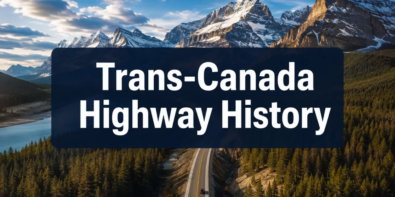
🇨🇦 History of the Trans-Canada Highway: From Vision to a Nation United

Sharing is SO MUCH APPRECIATED!


Last updated: July 24, 2026
Quick Answer: The Trans-Canada Highway is a federally funded national road that stretches approximately 7,821 kilometres (4,860 miles) from Victoria, British Columbia, to St. John’s, Newfoundland. Construction began in 1950 under the Trans-Canada Highway Act, and the route was officially declared open in 1962, though full completion took until 1971. It remains one of the longest national highways in the world.
Key Takeaways
- The Trans-Canada Highway Act was passed in 1949, authorizing federal funding for the first time.
- The highway officially opened on September 3, 1962, at Rogers Pass, British Columbia.
- Full completion across all provinces took until 1971.
- The route passes through all ten Canadian provinces, connecting Victoria, BC, to St. John’s, NL.
- Construction cost an estimated $1 billion (Canadian) by the time the highway was declared complete.
- The federal government covered 50% of construction costs; provinces covered the rest.
- Building through the Rocky Mountains and the Canadian Shield presented the most serious engineering challenges.
- Worker deaths occurred during construction, though exact national records were not centrally tracked; provincial records suggest dozens of fatalities across the project.
- The highway has been expanded, twinned, and upgraded significantly since 1962.
- It serves as a critical artery for trade, tourism, and national identity.
Why Was the Trans-Canada Highway Created?
The Trans-Canada Highway was created to physically unite Canada’s provinces with a single, continuous paved road, something the country had never had before. Before the 1950s, driving coast to coast meant navigating a patchwork of provincial roads, many of them unpaved, poorly maintained, or simply missing.
Canada’s post-World War II economy was growing fast. The federal government, under Prime Minister Louis St. Laurent, recognized that a reliable national highway would:
- Boost trade between provinces
- Support the growing automobile culture
- Strengthen national identity and sovereignty
- Open up remote regions to settlement and commerce
The Trans-Canada Highway Act of 1949 made it official. For the first time, the federal government committed to sharing the cost of building a national road.
When Was the Trans-Canada Highway Built?
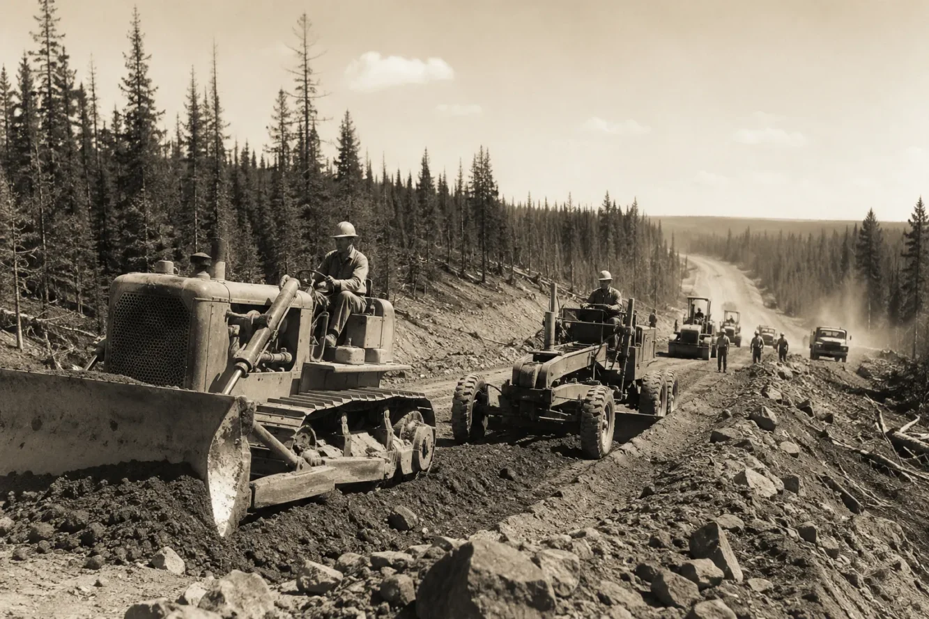
Construction formally began in 1950, following the passage of the Trans-Canada Highway Act in 1949. Work proceeded province by province, with each region responsible for its own section under federal cost-sharing agreements.
Key dates in the history of the Trans-Canada Highway:
| Year | Milestone |
|---|---|
| 1949 | Trans-Canada Highway Act passed |
| 1950 | Construction begins |
| 1962 | Official opening ceremony at Rogers Pass, BC |
| 1965 | Newfoundland section largely complete |
| 1971 | Final sections paved; highway declared fully complete |
The official opening on September 3, 1962, was a ceremonial moment, but large sections still required years of additional paving and improvement after that date.
How Long Is the Trans-Canada Highway?
The Trans-Canada Highway spans approximately 7,821 kilometres (about 4,860 miles), making it one of the longest national highway systems in the world. The route runs from the ferry terminal in Victoria, British Columbia, on the Pacific coast, to St. John’s, Newfoundland, on the Atlantic.
For context, that distance is roughly equivalent to driving from London, England, to Tehran, Iran, in a straight line.
What Provinces Does the Trans-Canada Highway Go Through?
The Trans-Canada Highway passes through all ten Canadian provinces. No territories are included in the official route.
Province-by-province route (west to east):
- British Columbia (Victoria to the Alberta border)
- Alberta (through Calgary)
- Saskatchewan (through Regina)
- Manitoba (through Winnipeg)
- Ontario (through Sault Ste. Marie and Sudbury)
- Quebec (through Montreal)
- New Brunswick (through Moncton)
- Nova Scotia (through Truro)
- Prince Edward Island (via the Confederation Bridge, added later)
- Newfoundland and Labrador (to St. John’s)
Major cities connected include: Victoria, Vancouver, Calgary, Regina, Winnipeg, Toronto, Ottawa (nearby), Montreal, Fredericton, Halifax, and St. John’s.
How Much Did It Cost to Build the Trans-Canada Highway, and Who Funded It?
By the time the highway was declared complete in 1971, total construction costs had reached an estimated $1 billion Canadian. The federal government covered 50% of costs under the Trans-Canada Highway Act, with each province responsible for the remaining half of its own section.
This cost-sharing model was a significant policy shift. Before 1949, road building in Canada was entirely a provincial responsibility. Federal involvement accelerated construction considerably, though it also created disputes over standards and timelines.
Adjusted for inflation, the $1 billion figure would represent many billions of dollars in 2026 terms.
What Challenges Did They Face Building the Trans-Canada Highway?

Building the Trans-Canada Highway was one of the most demanding engineering projects in Canadian history. The route crossed some of North America’s most difficult terrain.
Major construction challenges:
- Rogers Pass, BC: Avalanche-prone slopes in the Selkirk Mountains required massive snow sheds and engineering solutions that were unprecedented at the time.
- The Canadian Shield (Ontario): Builders had to blast through some of the oldest and hardest rock on Earth. Progress was slow and expensive.
- Muskeg in Manitoba and Ontario: Soft, swampy ground made it difficult to lay a stable road base.
- River crossings: Dozens of major bridges were required across the country.
- Weather extremes: Construction crews dealt with temperatures ranging from -40°C in winter to extreme summer heat.
Regarding worker safety, the history of the Trans-Canada Highway includes a sobering human cost. Central records were not maintained at the federal level, but provincial construction records and historical accounts confirm that dozens of workers died during the project. Deaths resulted from blasting accidents, equipment failures, and harsh weather conditions. The exact national total has never been officially compiled, but historians estimate the figure at somewhere between 30 and 100 fatalities across all provinces over the two-decade construction period.
For those interested in Canadian infrastructure and community development, the highway’s construction story offers a powerful example of what large-scale public works demand.
How Long Did It Take to Finish the Entire Trans-Canada Highway?
From the passage of the Trans-Canada Highway Act in 1949 to full completion in 1971, the project took approximately 22 years. The official opening ceremony in 1962 marked the symbolic completion of a continuous paved route, but many sections remained narrow, unfinished, or substandard for nearly a decade after that.
Newfoundland, which only joined Confederation in 1949, faced the added challenge of building its entire section from scratch with limited existing infrastructure.
Has the Trans-Canada Highway Been Expanded or Improved Since It Opened?
Yes, significantly. The Trans-Canada Highway has undergone continuous upgrades since 1962. Many sections that opened as two-lane roads have been twinned (expanded to four lanes) to handle modern traffic volumes.
Notable improvements include:
- Twinning projects across Alberta, Saskatchewan, and British Columbia
- The Confederation Bridge (1997): Connected Prince Edward Island to New Brunswick, replacing the ferry crossing
- Rogers Pass improvements: Ongoing avalanche control and tunnel construction
- Urban bypasses around major cities to reduce congestion
As of 2026, twinning projects continue in several provinces. Some rural sections in Ontario and Newfoundland remain two lanes, and safety advocates continue to push for upgrades. Concerns about flooding and extreme weather affecting highway infrastructure have also grown in recent years, adding new urgency to maintenance programs.
What Makes the Trans-Canada Highway Different from Other Major Canadian Highways?
The Trans-Canada Highway is the only federally designated national highway that spans coast to coast through all ten provinces. Other major Canadian highways, such as the Yellowhead Highway (Highway 16) or the Trans-Canada Alternate routes, serve regional purposes but were not built under the same federal cost-sharing framework.
Key distinctions:
- Marked by the distinctive white maple leaf on a green background sign
- The only highway with a formal federal act governing its construction and standards
- Designed specifically for national unity and interprovincial connectivity
- Longer than the U.S. Interstate Highway System’s longest single route
Those interested in standing up for Canadian national interests will find the highway’s political history as compelling as its engineering story.
Are There Dangerous or Difficult Sections of the Trans-Canada Highway?
Several sections of the Trans-Canada Highway are known for being particularly hazardous. Rogers Pass in British Columbia remains one of the most avalanche-prone highway corridors in North America, requiring active avalanche control programs year-round. The Trans-Canada through the Rocky Mountains also features steep grades, sharp curves, and heavy truck traffic.
In Ontario, the stretch through the Canadian Shield north of Lake Superior is known for wildlife collisions, especially moose, which pose a serious danger to drivers at night. Fog and ice conditions in Newfoundland and New Brunswick also contribute to higher accident rates on those sections.
Drivers planning long-distance trips should check road conditions, especially in winter. Those who enjoy winter travel and snowmobiling in Ontario will recognize how quickly conditions can change on northern Canadian roads.
Conclusion
The history of the Trans-Canada Highway is a story of national ambition, engineering determination, and real human sacrifice. From the 1949 act that made it possible, through two decades of blasting, bridging, and paving, to the ongoing upgrades of 2026, this highway has shaped how Canadians move, trade, and think about their country.
Actionable next steps for readers:
- If you plan to drive the Trans-Canada Highway, research current road conditions through provincial transportation websites before departure.
- Advocate for continued twinning and safety upgrades in your province by contacting local representatives.
- Explore the historical markers and interpretive sites along the route, especially at Rogers Pass National Historic Site.
- For those interested in Canadian history and policy, reviewing the original Trans-Canada Highway Act offers insight into how federal-provincial cost-sharing shaped modern Canada.
The highway is more than asphalt. It is a physical expression of what it means to be a connected nation, and its story is still being written.
Frequently Asked Questions
When did construction on the Trans-Canada Highway begin?
Construction began in 1950, one year after the Trans-Canada Highway Act was passed in 1949.
How long is the Trans-Canada Highway in kilometres?
The Trans-Canada Highway is approximately 7,821 kilometres long, stretching from Victoria, BC, to St. John’s, NL.
When was the Trans-Canada Highway officially opened?
The highway was officially opened on September 3, 1962, at a ceremony at Rogers Pass, British Columbia.
How many workers died building the Trans-Canada Highway?
Exact national figures were never centrally recorded. Based on provincial records and historical accounts, historians estimate that between 30 and 100 workers died during the roughly 22-year construction period, primarily from blasting accidents, equipment failures, and extreme weather.
Who paid for the Trans-Canada Highway?
Costs were split 50/50 between the federal government and each province, as established by the Trans-Canada Highway Act of 1949.
What provinces does the Trans-Canada Highway pass through?
All ten Canadian provinces: British Columbia, Alberta, Saskatchewan, Manitoba, Ontario, Quebec, New Brunswick, Nova Scotia, Prince Edward Island, and Newfoundland and Labrador.
How long did it take to build the Trans-Canada Highway?
Approximately 22 years, from the start of construction in 1950 to full completion in 1971.
What is the most dangerous section of the Trans-Canada Highway?
Rogers Pass in British Columbia is widely considered the most hazardous section, due to avalanche risk and mountain driving conditions.
What does the Trans-Canada Highway sign look like?
It features a white maple leaf on a green background, making it instantly recognizable from other provincial highway signs.
Has the Trans-Canada Highway been expanded since 1962?
Yes. Many sections have been twinned from two lanes to four, and the Confederation Bridge (1997) replaced the PEI ferry crossing. Upgrades continue as of 2026.
References
- Government of Canada. Trans-Canada Highway Act, S.C. 1949. Library and Archives Canada.
- Mika, Nick, and Helma Mika. The Trans-Canada Highway. Mika Publishing, 1991.
- Natural Resources Canada. “National Highway System.” nrcan.gc.ca, 2019.
- Parks Canada. “Rogers Pass National Historic Site.” pc.gc.ca, 2021.
- Statistics Canada. “Road Infrastructure and National Transportation.” statcan.gc.ca, 2020.
Meta Title: History of the Trans-Canada Highway Explained
Meta Description: Discover the full history of the Trans-Canada Highway, when it was built, how long it took, what it cost, worker deaths, and how it changed Canada forever.
Tags: Trans-Canada Highway, Canadian highway history, Trans-Canada Highway Act, Rogers Pass, Canadian infrastructure, highway construction Canada, coast to coast Canada, national highway Canada, Canadian history, highway engineering, province highway route, Canadian roads
Sharing is SO MUCH APPRECIATED!